0+
Plots geo-tagged
0%
Field verified
0+
Conflicts caught
0+
Open complaints
Offline-First Capture
Connect any RTK rover, capture survey-grade points, close the boundary — even with no signal in the field.
Nothing Hidden, Ever
Every approved survey gets a permanent Geo ID and QR code, verifiable by anyone.
One Practice, Full Stack
Field app, office CRM, and public registry — run the whole practice from one place.
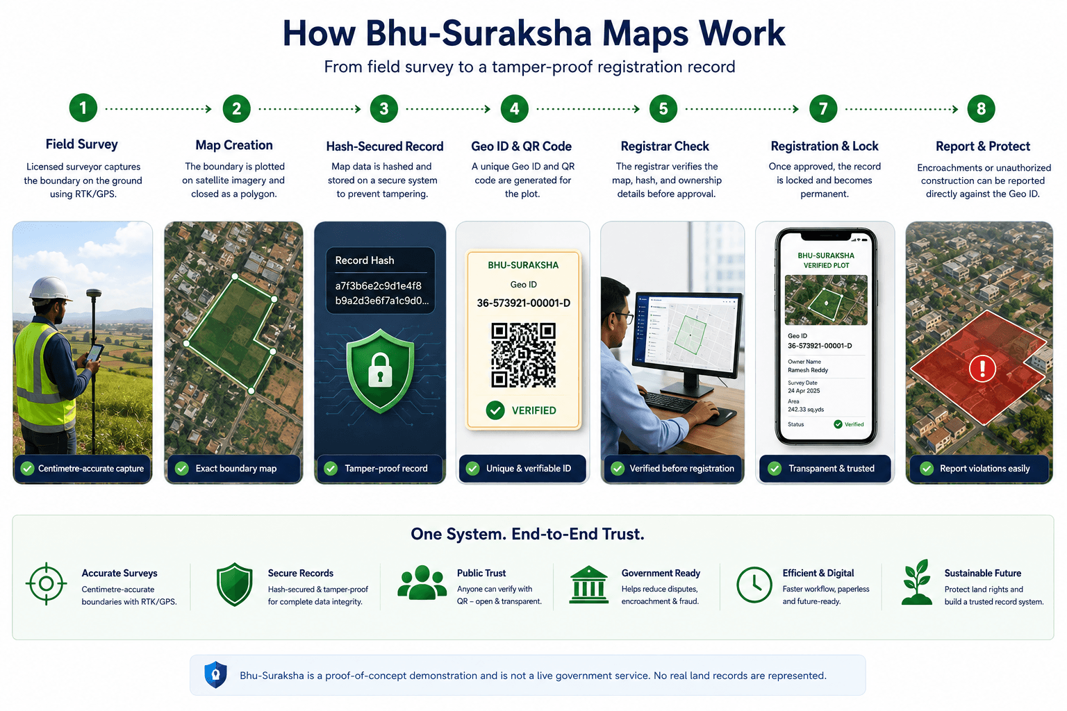
How Bhu-Suraksha maps work
From field survey to a tamper-proof registration record.
What we run (and run well)
Field
Offline-first RTK capture. Connect any rover, capture only survey-grade points, close the boundary, sign on the spot.
Office
Run the practice: leads, quotes, scheduling, deliverables, GST invoices, and UPI payments — in one place.
Registry
Every approved survey gets a permanent Geo ID and QR code — verifiable by anyone, re-stakeable by any surveyor.
Why surveyors trust us
GPS-Precise
Centimetre-accurate boundaries captured with real RTK hardware, not guesswork.
Works Offline
Field capture doesn't stop when the signal does.
Instantly Verifiable
Every plot gets a permanent Geo ID and QR code anyone can check.
Licensed & Compliant
Built for the moment Telangana made licensed-surveyor maps compulsory.
Conflict-Aware
Overlapping boundaries get caught automatically, not after a dispute.
Run the Whole Practice
Leads, quotes, GST invoices, and UPI payments — alongside your survey data.
The old way vs. Bhu-Suraksha
The old way
- Paper deeds & hand-drawn sketches
- Boundaries settled by hearsay
- Disputes discovered too late
- No offline field capture
- Status is a phone call away
Bhu-Suraksha
- GPS-precise digital capture
- Permanent Geo ID + QR code
- Conflicts caught automatically
- Offline-first field app
- Real-time status for every plot
Choose your path
Ready to make your first survey permanent?
I'm a surveyorBhu-Suraksha
A field-survey, office, and public-registry platform for licensed land surveyors in India.